Tuesday 10th November 2020
SOCIAL SCIENCE
6º A and 6º B
We start by checking the physical map you drew in the weekend.
Next we go to pages 28 and 29 to learn about Europe's Relief
We label the main mountain ranges in our maps.
We can play guessing games saying the countries were the different mountain ranges are located, and their capital cities.
We use the big physical map in class or this blank map.
Next, we do activities 1 and 2 in our notebook.
HOMEWORK
Do activities 1 and 2 pages 28 and 29
Finish labelling mountain ranges on the map.
Do Interactive Worksheet 22 (SOCIAL SCIENCE 6º)
Second Lesson 6º B and Wednesday Lesson 6º A
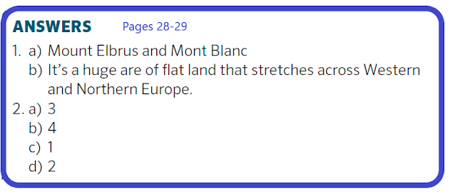
We correct activities 1 and 2
We cut out the names of the main mountain ranges in Europe and use them to label the physical blank map provided last Friday. You don't have to glue them, just put them on the right place with your books closed.
We do activity 3
We take a QUIZ. Write numbers 1 to 5 on your notebook. Listen and write A or B.
Here you can see the answers to activities 3 and 5
Next we work in our Map, trying to label the main mountain ranges mentioned in the book.


No hay comentarios:
Publicar un comentario